Recently, the IGERT group spent several days in Wroclaw, Poland to learn about the Odra River (Oder River) and to try out some role-play simulation games used as communication tools in community dialog. After traveling through Austria and the Czech Republic by train, we were met in Wroclaw by our host for our stay in Poland, Dr. Piotr Magnuszewski. Piotr is the managing director and co-founder of the Centre for Systems Solutions in Wroclaw. 
Sunrise illuminating the charming central square of Wroclaw called Rynek. We arrived in Wroclaw late in the evening and didn’t get to see much of this city. However, the first morning’s sunrise revealed the colorful facades of the main square.
Our guide during the river field trip on the first day was Dr. Andrzej Dunajski, a professor at the University of Wroclaw. We toured multiple sections of the Odra River to better understand the boundary of the former floodplain, the current floodplain enclosed by dikes, and areas of forest that are being managed for future floodplain use. We also looked at the affects the impoundments have had on the river channel.
Odra River Basin. The area we toured was in the vicinity of Wroclaw, which can be located at roughly latitude 51°N, longitude 17°E.

Andrzej and Christina looking at a map of land types around the Odra River. Note that the dark lines are where the current dykes are installed and the dotted lines are the historic floodplain.
 Impounded surface water in a reservoir created by damming the Odra River; this pond is popular for fishing.
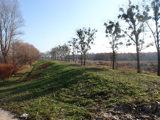 Bottom: Earthen levee that runs along the Odra River. Top: Trees with the festive Viscum album (mistletoe).

Incised channel bed downstream from the dam.
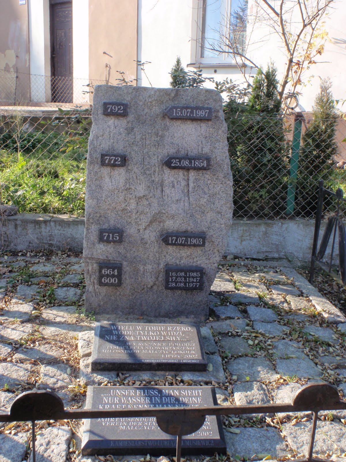
 A monument that memorializes the height of major flooding events in the past. The entire region was greatly affected by the flood in the summer of 1997.
 At this point, we broke for lunch in the small town of Lubiaz, where we ate at a quaint restaurant and toured the Cistercian Abbey. Some of us enjoyed the polish specialties pierogi, dumplings with various fillings, and zurek, sour rye soup with hard boiled eggs and sausage.


 Various pictures of the Abbey, built by Benedictines in 1150.

After our late lunch it was time for a stroll through the floodplain forest at dusk.
We spent the second and third day in Wroclaw playing the Floodplain Management Game and learning observation techniques through role-playing exercises. Joanna Stefanska, an environmental psychology lecturer at the University of Warsaw and consultant for Centre for Systems Solutions, joined us to observe our game play on the first day and teach us observation techniques on the second day. Piotr facilitated the game play with assistance from Magdalena Liszka and Michal Pajak, employees at the Centre for System Solutions. Carl Salk also participated in the game, as he will be using techniques learned from these activities to help understand the ways that cooperation and conservation impact governance in tropical forests.

All of us are engrossed in reading the instructions and synopsis of our roles before the game play starts. Joe was the mayor of the town and Christina was the head of the water board, the rest of us were farmers.
 Here I am discussing my water needs as a forester with the head of the water board (Christina).
 Carl, a cultivator of orchards in the game, is getting money from the town’s banker (Magda).

Kristine and Joana discuss with Piotr the recent rise in the river’s water level in comparison to the levees.
 The game board. The blue numbers indicate parcels of land, the cards with numbers contained in houses indicate which farmer parcels belongs to, and the cards with colored borders show the type of production on that parcel and the variety of assets associated with that parcel.
 At the end of each turn we had to tally our income from assets minus our losses from inadequate soil moisture, low biodiversity, inadequately controlled flows, and flooding.

Here I am working with the mayor (Joe) to get a fish pond for one of my low lying parcels. In the background Joanna is observing our interaction.
 Michal ran the computer simulation that generated values for biodiversity loss, rain fall, soil moisture, and flooding.

Group photo at the conclusion of game play and discussion.
Photo credits: Trisha Spanbauer, Christina Hoffman, and Piotr Magnuszewski